|
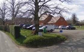
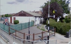
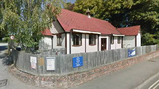
| Upper Basildon Village Hall |
 |
|---|
Bethesda Street, RG8 8NU
Google
StreetMap
What3Words: porch.regulator.pictures
In Lower Basildon, take the turning opposite the garage on the A417.
Hall on the right shortly after entering 30mph zone.
Car Park
Used by:
Upper Basildon Folk Dance Club
|
|
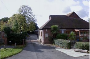
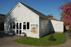
| Chinnor Church Hall |
 |
|---|
High Street, Chinnor, OX39 4DH
Google
StreetMap
What3Words: relished.vibe.presume
behind the Village Centre
Used by:
Chinnor Folk Dance Club
|
|
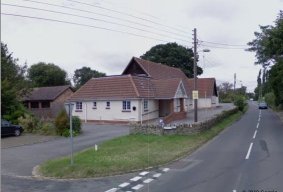
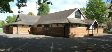
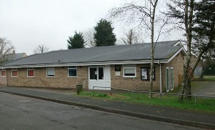
| Cumnor Village Hall |
 |
|---|
Leys Rd, OX2 9QF
Google
StreetMap
What3Words: ruling.costumed.storming
On edge of Cumnor village on the B4017 Cumnor to Farmoor Road.
Easily accessible with plenty of car parking space
Used by:
St. Andrew's Assembly English Country Dance Club
Sunday Playford
Additional Events:
Folk Dance Music Workshop and evening dance : Sat 30 May
Tea Dance : Sat 20 Jun
Jane Austen Ball : Sat 15 Aug
Christmas Party Dance : Sat 19 Dec
Tea Dance : Sat 19 Jun 2027
Jane Austen Ball : Sat 14 Aug 2027
Christmas Dance and Party : Sat 18 Dec 2027
|
|
| Eye and Dunsden Village Hall |
Photograph not available |
|---|
Dunsden Green, RG4 9QG
Google
OpenStreetMap
What3Words: leap.aware.listed
Used by:
Dunsden Green Country Dance Club
|
|
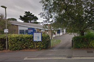
| Gladstone Road Community Centre |
 |
|---|
Headington, OX3 8LL
Google
StreetMap
What3Words: mull.thin.clots
Car Park
Used by:
Headington Quarry Folk Dance Club
|
|
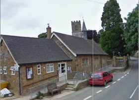
| Hagbourne Village Hall |
 |
|---|
East Hagbourne, OX11 9LR
Google
StreetMap
What3Words: snooping.plant.cultivation
Opposite the School, on the road to West Hagbourne
Car Park
Used by:
Hagbourne Barn Dance Club
|
|
| Steventon Village Hall |
 |
|---|
The Green, OX13 6RR
Google
StreetMap
What3Words: coasted.squirted.nags
Used by:
Wantage Folk Dance Club
Additional Events:
Friday Folk at Steventon : Fri 5 Jun
Friday Folk at Steventon : Fri 3 Jul
Friday Folk at Steventon : Fri 7 Aug
Friday Folk at Steventon : Fri 4 Sep
Friday Folk at Steventon : Fri 2 Oct
Friday Folk at Steventon : Fri 6 Nov
Friday Folk at Steventon Christmas Party Dance : Fri 4 Dec
|
|
| Stonesfield Village Hall |
 |
|---|
Field Close, OX29 8EF
Google
StreetMap
What3Words: pram.carefully.chaos
Car Park
Used by:
Stonesfield Folk Dance Club
|
|
| Tadmarton Village Hall |
 |
|---|
Main Street, OX15 5SG
Google
StreetMap
What3Words: cries.shakes.jabs
Car park at the rear, access via the track to the left of the building
On the B4035 4 miles west of Banbury
Used by:
Tadmarton Folk Dance Club
|
|
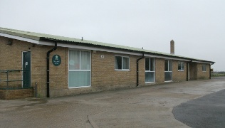
| Shaw cum Donnington Village Hall |
 |
|---|
Love Lane, Donnington, Newbury, RG14 2JG
Google
StreetMap
What3Words: life.league.select
Car Park
Used by:
Thatcham Folk Dance Club
|
|
| Towersey Memorial Hall |
 |
|---|
Chinor Rd, OX9 3QY
Google
StreetMap
What3Words: ropes.milky.hotspots
Used by:
Towersey Folk Dance Club
|
|
| Yarnton Village Hall |
 |
|---|
The Paddocks OX5 1TE
Google
StreetMap
OpenStreetMap
What3Words: fears.sprouted.cheesy
Car Park
Events:
Oxfordshire Folk Dance Association Playford Ball : Sun 4 Oct
Oxfordshire FolkDance Association Playford Ball : Sun 3 Oct 2027
|